Skip to content

November 4, 2014

Diary of a Slow Moving Disaster

by Herb Saperstone
IMG_0695

Courtesy USGS. This Kiluea Volcano flow of June 27 pushed through a fence marking a property boundary above Pāhoa early on Oct 28, 2014.  Here, the flow is inflated to a height around 4 feet.

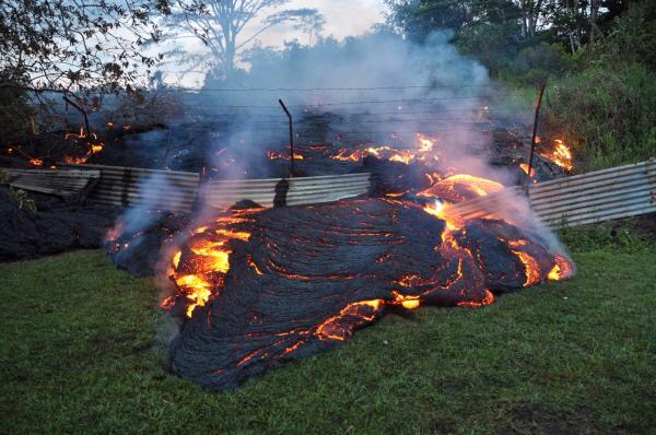
On the island of Hawaii, residents are all too familiar with lava flows encroaching on their properties. In 1986, the town of Kalapana was overun by flows destorying homes, vehicles, roads and vegetation- leaving swaths of unwelcome basalt throughout this Hawaiian community. Creeping at speeds of several kilometers/hour, you can certainly out-walk these- but with temperatures of active flows between 500 and 1400 C, they are extremely dangerous forces of nature. The USGS has a day by day video/photo chronology you can follow here.

Read more from Geology, Science Education

Leave a Reply

Fill in your details below or click an icon to log in:

WordPress.com Logo

You are commenting using your WordPress.com account. Log Out /  Change )

Facebook photo

You are commenting using your Facebook account. Log Out /  Change )

Connecting to %s

Note: HTML is allowed. Your email address will never be published.

Subscribe to comments

%d bloggers like this: