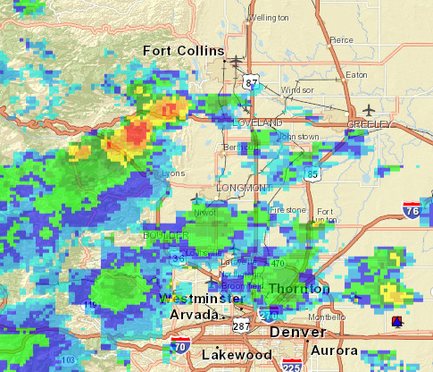
 Radar imagery reveal late May thunderstorms blooming along a southwest to northeast line southwest of Fort Collins on the afternoon of May 25. Time lapse imagery facing south captures the drama of north and westerly flow- a bit unusual as most summer storms track east and northeast from the mountains to the plains. Late spring in northern Colorado has brought a lot of moisture- with the threat of stream flooding now and in the days to come. Snowpack in the mountains is still about half melted so a string of warm weather could add to river discharge here and downstream.
Published by
Categories: Climate/Weather

Leave a comment